Fixed Site Network
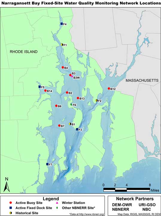
The Narragansett Bay Fixed Site Monitoring Network (NBFSMN) is a multi-agency collaborative that equips, operates, and conducts data analysis and reports on multi-station monitoring networks for temperature, salinity, DO, turbidity, and chlorophyll. The system continuously collects data on these parameters at 13 fixed locations (8 buoys and 5 fixed dock sites) throughout the bay with a focus on the upper bay where hypoxia is most likely to occur. Most buoys are equipped to take readings near the surface (0.5-1.0 meters below the water’s surface) and near the bottom (0.5-1.0 meters above the floor). A few buoys also take readings at a middle location between the surface and bottom. Locations are operational from May through October, with four buoys operating year round. The NBFSMN takes readings every 15 minutes, with five stations providing real-time data online.
While other monitoring systems obtain more detail on spatial variation (see Field Surveys below), the NBFSMN provides the most detailed information on temporal variation—measuring how conditions are changing within a week, day, or even an hour. Information on both spatial and temporal patterns is crucial to understanding how the Narragansett Bay ecosystem works.
As a compliment to operating fixed sites as part of the NBFSMN, the Narragansett Bay National Estuarine Research Reserve also conducts other relevant monitoring activities near Prudence Island. This includes year round monitoring of weather conditions (air temperature, humidity, pressure, wind, and precipitation) that can impact the likelihood of hypoxia, monitoring similar to the NBFSMN criteria at one additional site, and monitoring nutrients at four sites.
Field Surveys
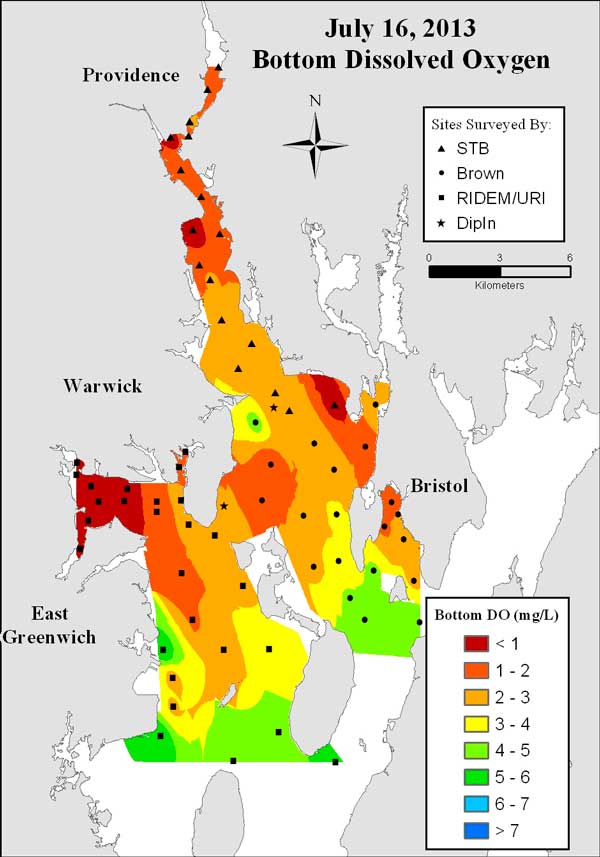
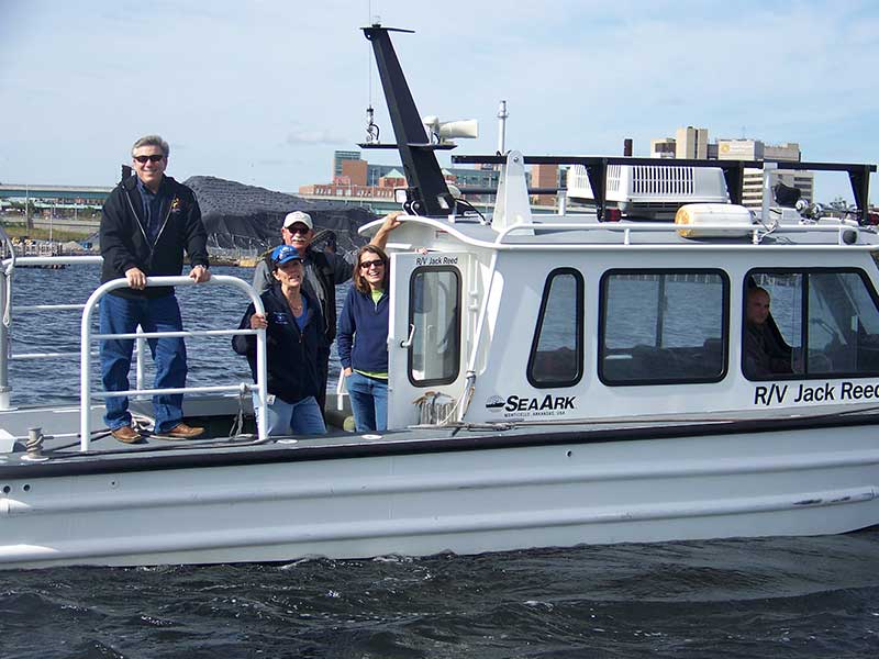
Brown University, RI Department of Environmental Management, the University of Rhode Island, Narragansett Bay Commission (NBC), and Save The Bay in cooperation with additional partners have conducted boat-based surveys to evaluate the spatial extent of hypoxic conditions. These surveys are conducted every summer during neap tides when tidal mixing and dissolved oxygen are expected to be lowest, which are two conditions that lead to low DO events. The boat surveys collect data on temperature, salinity, DO, chlorophyll, and turbidity.
Seventy-seven stations throughout the Providence and Seekonk Rivers, Greenwich Bay, and the East and West Passages of Narragansett Bay were monitored XX times during neap tides from XXX to XXX. At each station, a depth profile is taken, starting at one meter below the surface, and then going deeper, taking readings every five to six centimeters. These data are currently being processed by Brown University with funding provided by the Narragansett Bay Estuary Program.
In addition, NBC samples weekly from Memorial Day to Labor Day and twice per month for the remainder of the year at eight Providence and Seekonk River stations. NBC collects data similar to and with the same instrumentation as the Brown University-led surveys: DO, temperature, salinity, and density, as well as fluorescence and photosynthetically active radiation (PAR, the amount of solar radiation that can be used by organisms for photosynthesis).
Implemented By
Fixed Site Network
- Rhode Island Department of Environmental Management
- University of Rhode Island Graduate School of Oceanography
- Narragansett Bay Commission
- Narragansett Bay National Estuarine Research Reserve
- United States Environmental Protection Agency
- National Oceanic and Atmospheric Administration
Field Surveys
- Brown University
- Save The Bay
- Rhode Island Department of Environmental Management
- Narragansett Bay Estuary Program
- Narragansett Bay Commission
- University of Rhode Island Graduate School of Oceanography